
Thanks for the info Kevin. It's nice to know you still take a look @ the info once in a while. The picture you have of the ice fishing I presume is not the Swan Lake near Vernon as that likely is just about ready to be ice free. Anyway I was curious how you get into Babe Lake so I enlarged the map and added Google earth as pdf's so you can suggest a likely method. This should allow more than an X.
Thanks
Larry
Locate the Recreation Site
Re: Locate the Recreation Site
- Attachments
-
- Babe GE.pdf
- (492.89 KiB) Downloaded 345 times
-
- Babe Garmin.pdf
- (423.03 KiB) Downloaded 360 times
-
BCDelica

- Posts: 1808
- Joined: Tue Jul 18, 2006 4:12 pm
- Member's Photo Album: http://www.delica.ca/Photos/index.php?cat=10008
- Vehicle: WVO Powered Tuk Tuk
- Location: Central Van Isle
- Location: Somewhere with plenty of sun
Re: Locate the Recreation Site
Always keep posted and of course my mind always drift to fishing. That was Swan between Grande Prairie and Dawson Creek, with the BC and Alberta border running down the middle of the lake. https://www.facebook.com/events/1661968264069701/.Though it's been a far warmer winter than normal, but with so much less snow we had 30 inches of ice!
The road, start of to the south of the lake, does show on the Garmin map, it's was never really a road and wanders through the trees.
One of these lakes nearby shares my surname.
Cheers,
Kevin
The road, start of to the south of the lake, does show on the Garmin map, it's was never really a road and wanders through the trees.
One of these lakes nearby shares my surname.
Cheers,
Kevin
 Call me BCDelica-less
Re: Locate the Recreation Site
Well Wayne ( TLGorWF or Moby ( short for Mobile) Dick ) I went out to Morgan today to check it out and judging from the number of people it must have been open for more than a week, I attached pictures of it and Six Mile to show you can fish near Kamloops in March no problem if you have a snowmobile suit and a thermos!!
- Attachments
-
- Morgan from the North End
- 100_7571a.JPG (155.59 KiB) Viewed 8102 times
-
- Morgan from the South End
- 100_7574a.JPG (159.17 KiB) Viewed 8102 times
-
- Six Mile Boat Brigade
- 100_7575a.JPG (151.26 KiB) Viewed 8102 times
-
- Silly Shore fishermen,kids etc.
- 100_7576a.JPG (192.58 KiB) Viewed 8102 times
-
- Feathered fisherbirds in a pond near Six Mile
- 100_7578a.JPG (265.12 KiB) Viewed 8102 times
-
thelazygreenfox
- Posts: 904
- Joined: Tue Jun 08, 2010 7:21 am
- Member's Photo Album: http://www.delica.ca/Photos/
- Vehicle: 99 white Hi roof gas Chamonix
- Location: Coquitlam B.C.
- Location: coquitlam canada
Re: Locate the Recreation Site
Larry
That's great news. Any fish being caught? By you I hope!!
MD
Thats Moby Dick as in the great white whale....
That's great news. Any fish being caught?
MD
Thats Moby Dick
Wear your mask, it keeps others from seeing the parsley in your teeth
Re: Locate the Recreation Site
Tunkwa and Leighton Lakes are in a Provincial Park southwest of Kamloops. Tunkwa is known for growing large fish in significant quantities. The lakes are @ 3750 feet so can produce fish even in the summer. I took an number of pictures of the park some time ago as it has a special layout which would suit a “large” Delica meet for the interior, BC or even Western Canada if the interest was there. The park has a large number of quad sites which provide 4 tables around a single fire pit which is great for groups. Usually the sites are quite spread out and as the park allows informal camping this could easily grow to double that if desired. The sites are mostly open, as are the lakes, but a few treed sites are available for those who want a single site. The park is large and could accommodate 50 or more units with little trouble.
In addition to fishing the park has a dedicated ATV area and lots of trails are available in the area for mountain biking or hiking for those interested. ( Logan Lake is quite close and has a liquor outlet for those that come ill prepared.)
I have provided a map showing various routes to the park. It is easily accessible from the Coquihalla, Connector, #1 highway and a few more adventuresome routes. If anyone is interested in the site or attempting to get a group together for a meet we could start an event on the forum. It seems that the meets have trouble getting even a few together so maybe it's time we tried the other approach and go for the MEGGA Event!! I would recommend late August or early September if anyone is interested.
- Attachments
-
- Typical quad table site
- 100_4422a.JPG (215.72 KiB) Viewed 8068 times
-
- Quad tables near small bay
- 100_4423a.JPG (241.85 KiB) Viewed 8068 times
-
- Larger area showing quantity of sites
- 100_4425a.JPG (207.14 KiB) Viewed 8068 times
-
- ATV area and trails
- 100_4426a.JPG (325.57 KiB) Viewed 8068 times
-
- Routes to Tunkwa from various directions. North to the Left.
- Routes to Tunkwaa.jpg (257.85 KiB) Viewed 8068 times
Re: Locate the Recreation Site
I spent a day exploring potential camping and fishing lakes up Deadman Creek earlier this spring as I hadn't been their for some time and wanted to confirm boat launches. Deadman Creek road is north of Hwy. #1 between Cache Creek and Savona. The road was built in the early days to reach a Gold mine @ Vidette. The lakes in the valley are quite small and very narrow. The fishing quality depends on who you talk to. The nice part is it is a low elevation so can have ice off quite early. The drive is quite interesting with several changes in topography including some interesting HooDoo's right adjacent to the road. A Rec site is available @ Skookum Lake but really isn't much more than a pull-off from the road. The Deadman lake site is nicely treed and quite open with a few sites right on the lake shore. Beyond Deadman lake is Vidette Lake with a nice site across the road from the lake as well as a small resort. If you venture this far a trip to Deadman Falls is a must. From what I can determine they are between 150 and 200 feet. Pretty impressive when you can get as close as you want. I have a route map if anyone is interested which I can add as a jpg or a pdf.
- Attachments
-
- HooDoo's near Skookum Lake
- 100_7611a.JPG (105.08 KiB) Viewed 8042 times
-
- Rec Site Sign @ Road
- 100_7605a.JPG (331.38 KiB) Viewed 8042 times
-
- Lakeside Camp site
- 100_7608a.JPG (225.02 KiB) Viewed 8042 times
-
- Caution Sign
- 100_7595a.JPG (286.2 KiB) Viewed 8042 times
-
- Top of the Deadman Creek Falls
- 100_7597a.JPG (330.09 KiB) Viewed 8042 times
-
- Deadman Creek Falls
- 100_7598a.JPG (145.66 KiB) Viewed 8042 times
-
msimps
- Posts: 35
- Joined: Wed Apr 06, 2016 7:59 pm
- Member's Photo Album: http://www.delica.ca/Photos/
- Vehicle: '94 L400 "The Trail Whale"
- Location: Delta
Re: Locate the Recreation Site
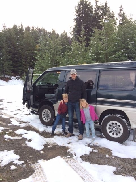
I've had "the green turtle" for about 3 months and the first real outing was to the Statlu Lake, which is found NE of Stave Lake and W of Harrison Lake. It's accessed off the Chelhalis-Mystery FSR and then you hike in. Some amazing falls on the way up, plus a beautiful, quiet lake (with a couple fish apparently). I'll be back soon to hike up to the upper lake (Brotherhood) and maybe spend a night at one of the camp sites. The Green Turtle ran like a dream...my interior/exterior thermometer even blinked on a couple times over the rough terrain


Re: Locate the Recreation Site
This past week I took a day to check out a few new sites for future trips. I came across the same unsightly mess @ each site. The picture below is from Loosemore Lake north of Princeton. Why do people need to build a new fire pit when one already exists or even worse remove the typical circular metal fire pit roll it down to the lake and then proceed to make a pit out of rocks, burn half their beer cans and top it off with a fresh diaper to put out the fire. It doesn't seem to matter if it's a 4x4 only site or ones you can access with an RV. This seems to be a more common occurrence these days and one almost has to take a big garbage bag to clean the place up before it's fit to use. Has anyone else found this problem or have any ideas for solutions. It really spoils to the trip to the pristine wilderness!!
On a more positive note I would like to thank msimps for his contrbutition and hope others will add their info on trips to Rec sites or other good camping spots.
On a more positive note I would like to thank msimps for his contrbutition and hope others will add their info on trips to Rec sites or other good camping spots.
- Attachments
-
- Fire Pits
- 100_7697a.JPG (315.44 KiB) Viewed 7991 times
Re: Locate the Recreation Site
After my little rant I'll get back to the benefit of Rec Sites. I camped @ Prosser Lake earlier this year. The lake is about 5km off Hwy 5A north of Princeton and easy to find. Other lakes are also located on this road and FSR roads can take you to Missezula and beyond if you wish. The road in is suitable for RV's except for the last km which is a challenge for 2WD vehicles but could be done if they have clearance. The boat launch requires 4WD to return up the hill. The site has 3 tables, 1 near the boat launch and 2 up the 'hill'. I am told fishing can be quite good and I've now talked to a guy that has caught lots of fish there. I spent my time @ a very nice drop off watching fish swim back and forth past several of my best flys. Next time WILL be different.
- Attachments
-
- Best camp spot & sign
- 100_7684a.JPG (309.36 KiB) Viewed 7979 times
-
- Boat launch
- 100_7686a.JPG (313.98 KiB) Viewed 7979 times
-
- Competition
- 100_7688a.JPG (331.72 KiB) Viewed 7979 times
-
- Lake view
- 100_7691a.JPG (160.22 KiB) Viewed 7979 times
-
- Route in from Hwy 5A
- Route from 5Aa.jpg (150.71 KiB) Viewed 7979 times
Re: Locate the Recreation Site
Frogmoore lake is really 2 lakes separated by a dam. It is a little off the beaten path, although very close to the Coquihalla Hwy. I visit it about every 2 years or so and is usually occupied but not busy. One very frustrating part of fishing the lake is the very aggressive loon. Hopefully it has gone to loon heaven by now. Both lakes produce fish with the east lake having better fish in quantity and quality. The journey to the east lake is via a channel which can be a little time consuming especially if a busy beaver is in action while you are fishing. The camping facilities are rustic but do include a toilet. Every thing else you provide. A nice lake for a day ( if camped @ Lac La Jeune ) or a weekend camp out. The route is about 21 km from the Logan lake turn off and if you are adventurous a 5th wheel has been seen @ the site so the road is easy for any Delica.
- Attachments
-
- Smaller west lake
- 100_4338a.JPG (194.51 KiB) Viewed 7932 times
-
- Channel to larger east lake
- 100_4335a.JPG (198.09 KiB) Viewed 7932 times
-
- Rough camp area between lakes
- 100_4339a.JPG (258.62 KiB) Viewed 7932 times
-
- Typical fish size
- 100_6787a.JPG (176.33 KiB) Viewed 7932 times
-
- Beaver dam blocking the way.
- 100_6788a.JPG (287.25 KiB) Viewed 7932 times
-
- NOTE: North is to the RIGHT of the picture.
- Route from coq.jpg (79.4 KiB) Viewed 7932 times
Re: Locate the Recreation Site
I recently completed a trip to Cariboo Mountains Provincial Park and thought others may be interested in the trip to an area of BC not often considered for a retreat from the rat race. The park is located between Bowron and Wells Gray Provincial Parks. The attraction for me was Ghost Lake and potential great fishing.
I have included a a route map to and from 100 Mile House. The route colors indicate the following:
Magenta: trip to Cariboo Mountains Provincial Park from 100 Mile House with a side trip to Pendleton Lake which is just above Mahood lake.
Green: A bridge on the magenta route near Horsefly was being replaced so I had to detour via Crooked Lake. This is a large very clear lake with a 2 site Rec Site right on the beach and a second site @ the north end for those who need more space.
Yellow: Return trip via Wells/Barkerville or a side trip to the Bowron Lakes.
Cyan: Return via Likely and 150 Mile House.
Entering @ 100 Mile House the road is paved to just past Canim Lake, from that point on except for a few km. near Horsefly and Likely the road is gravel and usually in good shape. The side trip to Pendleton was great again but the road definitely left a few pinstripes even though I did hack bush for the last 10 km. The trip north to Horsefly was a scouting mission for future trips and provided 6 Rec Sites for future camping (as noted by the little green tents). Most were larger lakes and some have camping right on the beach like @ Bosk and Crooked lake. Another 6 sites were along the road between Horsefly and Cariboo Mountains PP. The portion of the road from Likely to Barkerville is called the Gold Rush Trail with several signs along the road to point out some of the history.
See Part 2 for the remainder--
- Attachments
-
- Route from 100 Mile
- Route from 150 Mile.jpg (55.34 KiB) Viewed 7888 times
-
- Crooked Lake beach Rec Site
- 100_7811a.JPG (185.14 KiB) Viewed 7888 times
-
- Riverside Park in Likely
- 100_7822a.JPG (218.89 KiB) Viewed 7888 times
-
- Gold Rush Trail typical sign
- 100_7824a.JPG (358.73 KiB) Viewed 7888 times
-
- Cariboo Lake from Ladies Rec Site
- 100_7828a.JPG (127.41 KiB) Viewed 7888 times
Re: Locate the Recreation Site
Part 2 of Cariboo Mountains PP
The mountains near the park are over 8000 feet and some even had snow @ the top this time of year. The park itself is very rustic and looks rundown as maintenance must be a yearly thing @ most. The 2 remaining campsites have nice locations and the roar of the falls is very loud. The natural views available more than make up for the camp area. The falls are found via a trail and you can get right to the water if you wish as there are no barriers, signs or limitations. This can be dangerous but also gives access to see the power of the falls close up. The boat launch is a bit of a joke and unless you have a canoe, kayak or enough people to carry your boat to the lake fishing will be restricted to the shore. I tried fly casting from the shore but the log debris, my poor casting technique and the wet log footing made catching the little fish along the shore more of a chore than fun. The night I stayed @ the park we were 'treated' to a spectacular lightning show with thunder that seemed to last forever. If anyone wants further info or more specifics on the area please let me know.
The mountains near the park are over 8000 feet and some even had snow @ the top this time of year. The park itself is very rustic and looks rundown as maintenance must be a yearly thing @ most. The 2 remaining campsites have nice locations and the roar of the falls is very loud. The natural views available more than make up for the camp area. The falls are found via a trail and you can get right to the water if you wish as there are no barriers, signs or limitations. This can be dangerous but also gives access to see the power of the falls close up. The boat launch is a bit of a joke and unless you have a canoe, kayak or enough people to carry your boat to the lake fishing will be restricted to the shore. I tried fly casting from the shore but the log debris, my poor casting technique and the wet log footing made catching the little fish along the shore more of a chore than fun. The night I stayed @ the park we were 'treated' to a spectacular lightning show with thunder that seemed to last forever. If anyone wants further info or more specifics on the area please let me know.
- Attachments
-
- Typical scenery near the Park
- 100_7833a.JPG (270.02 KiB) Viewed 7887 times
-
- Campsite
- 100_7836a.JPG (306.02 KiB) Viewed 7887 times
-
- Upper falls
- 100_7839a.JPG (278.23 KiB) Viewed 7887 times
-
- Boat Launch Road
- 100_7848a.JPG (386.49 KiB) Viewed 7887 times
-
- Ghost Lake
- 100_7849a.JPG (337.7 KiB) Viewed 7887 times
-
- Ghost Lake shoreline
- 100_7851a.JPG (256.91 KiB) Viewed 7887 times
-
- Lower Falls from the bridge
- 100_7856a.JPG (268.5 KiB) Viewed 7887 times
Re: Locate the Recreation Site
I spent several days this month @ Mowson Pond near Gold Bridge after initially trying to get there via the Hurley FSR in June 2014. Snow was not a problem this time of year as it was in 2014. Mowson Pond area can be reached via the road from Lillooet, the Hurley FSR, or via the Pemberton Portage Road which goes via Seton Portage. Several methods are available to get to Lillooet from anywhere in the province.
Mowson Pond is a small lake up the Tyaughton lake road which can provide a good base for other fishing lakes in the area. It has about 7 sites with several only suited for tents. The site is used extensively by mountain bikers who come from all over to ride the trails in the mountains to the west. You almost feel out of place if you don't have @ least 2 bikes on the back of your vehicle. I don't know where they drove to in the morning but they always came back on their bikes. Most days they felt they road @ least 50 km.
The fishing while I was there was fairly spotty but every fish we caught was 22 or 23 inches or about 4 pounds. One or 2 of them a day should be enough for anyone. I'm really glad Claude ( Delica.ca member from Gun Lake) told me Mowson is the lake to fish in the area.
We also took a look @ other Rec Sites in the area and Kingdom Lake is a very nice site with smaller fish. HOWEVER, everyone immediately warns you about the mosquitoes if you go anytime during the summer. I'm almost tempted to go back in May or June to see if they are all exaggerating. I have some pictures if anyone is interested.
In addition to fishing and biking the history of the area ( gold) is interesting and if your looking for property houses are pretty cheap in Bralorne!!
- Attachments
-
- Possible Routes
- Alternate Routes a.jpg (442.34 KiB) Viewed 7804 times
-
- Sign @ road
- 100_7920a.JPG (767.17 KiB) Viewed 7804 times
-
- General site area
- 100_7901a.JPG (725.86 KiB) Viewed 7804 times
-
- Tenting sites near the water
- 100_7902a.JPG (731.46 KiB) Viewed 7804 times
-
- My new friend Mathew from Surrey with our catch for the first day!
- 100_7904a.JPG (653.23 KiB) Viewed 7804 times
-
msimps
- Posts: 35
- Joined: Wed Apr 06, 2016 7:59 pm
- Member's Photo Album: http://www.delica.ca/Photos/
- Vehicle: '94 L400 "The Trail Whale"
- Location: Delta
Locate the Recreation Site
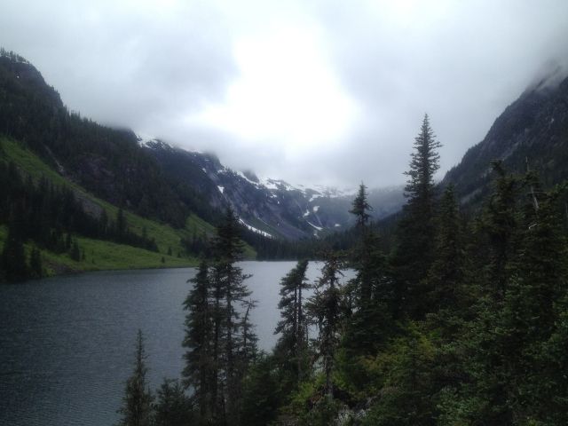
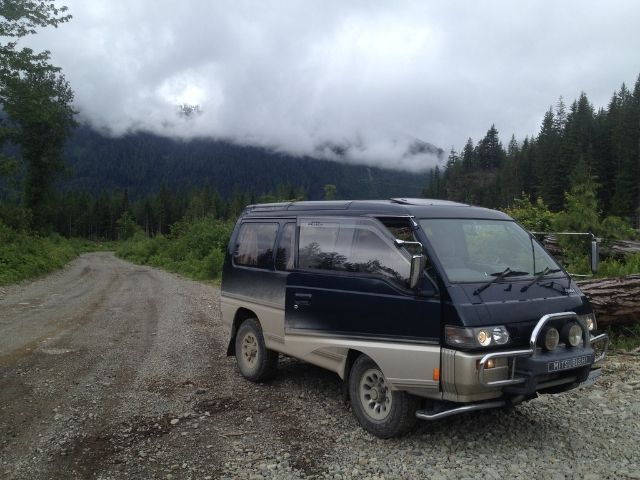
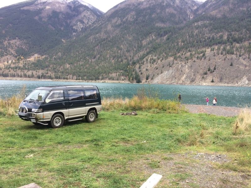
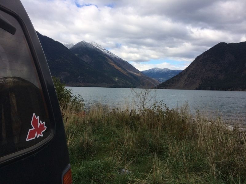
I took the 3 older kids up to visit Grandma in Lillooet. We had a day to explore so we decided to head to Seton Lake as we'd heard there was a beach/campsite that was only accessible via FSR or paddling up the lake. I'd brought the Green Turtle, so naturally we choose to take the FSR. We drove West along the 99 (Duffy Lake) out of Lilloet and found the FSR on the right just before the Cinnamon Rec site. It's about a 20km road I think, but it's steep and there's lots to see so it took us a while, but the kids loved the snow at the peak and throwing rocks at the beach. We even crossed paths with another L300! Simply follow the main FSR the whole way, but take the road that branches to the right just before the active logging site. It brings you to a secluded beach with a couple fire pits and a beautiful view. Will definitely be camping there next summer if we're up in Lillooet again.


Locate the Recreation Site
I took a look @ my BackRoads maps and think I found the road you took. It looks like quite a trip. The number of switchbacks shows just how steep the terrain is. The cyan route is the likely road but I also added the yellow option as a possible route that is kind of shown on Google Earth. The map shows a Rec site , is that where the beach its you referred to? Thanks msimps for sharing your trip and I'll definitely add it to any tours I take to the area.
- Attachments
-
- Seton Lake Rec Site Road
- Seton Rec.jpg (52.05 KiB) Viewed 7759 times