Page 15 of 20
Locate the Recreation Site
Posted: Mon Apr 17, 2017 9:50 am
by jimmyleduc
Sorry to jump in but my wife and i are curious how you find these roads?
My L400 is ready for action and we are new to BC so want to explore. Thanks
Envoyé de mon iPad en utilisant Tapatalk
Locate the Recreation Site
Posted: Mon Apr 17, 2017 11:34 am
by north54
jimmyleduc wrote:Sorry to jump in but my wife and i are curious how you find these roads?
My L400 is ready for action and we are new to BC so want to explore. Thanks
Envoyé de mon iPad en utilisant Tapatalk
Backroads mapbooks usually are a good help. Most likely can be found at your local library. Also sites such as clubtread.com are a wealth of info on the subject. Good luck.
Locate the Recreation Site
Posted: Mon Apr 17, 2017 1:39 pm
by jimmyleduc
Thanks
Envoyé de mon iPhone en utilisant Tapatalk
Locate the Recreation Site
Posted: Mon Apr 17, 2017 7:06 pm
by lrp374
The beginning of page 14 of this post lists the system I use. Backroad Maps as North 54 says are a great resource either in paper or GPS version. If your in Kamloops sometime we could meet for coffee and I can show lots of roads south of Revelstoke.
Locate the Recreation Site
Posted: Fri May 19, 2017 7:42 am
by lrp374
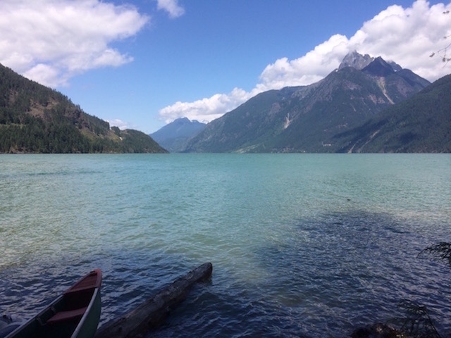
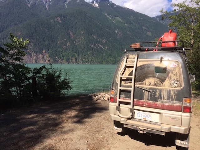
Scuitto is a small, very productive Lake SE of Kamloops. The lake for years has allowed rough camping but in recent years it has got out of control to the determent of the poor rancher that leases the property. I went up fishing yesterday and was very surprised to find a new recreation site c/w rail fences, defined sites and an attempt @ a boat launch. (I used the old overland launch as the new one was a gravel bog.) I'm sure it will be better in time but Texas pea gravel and my boat don't go together well. I included a picture of the old camping system as well as the new rec site and boat launch as well as a route map to the site. The new rec site has 8 sites @ present and if it's full a few km down the road is Campbell Lake with 31 sites that is only full on long weekends.
Locate the Recreation Site
Posted: Thu Jun 15, 2017 8:31 am
by lrp374
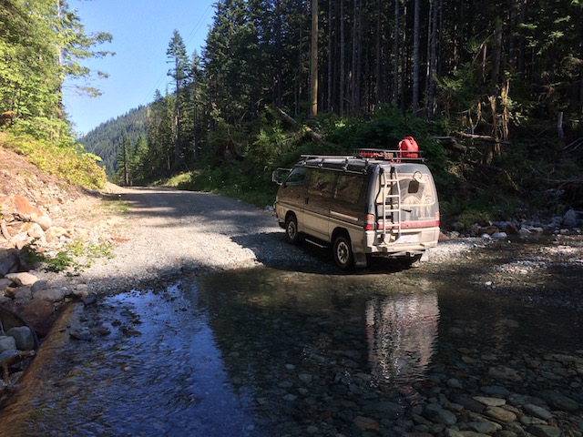
My first camp out of the year was to an area I visited early last year and was so appealing I made it the first trip. Fatox lake ( 3734 ' ) is southeast of Deadman Falls and is usually reached by a number of FSR's from Kamloops. This year the route was changed a little as the main road was washed out from the spring runoff. It is approximately 80 to 90 km to the lake from Kamloops using any of the 4 shorter routes. The area is far enough away that the lake only gets limited pressure. The site is rough camping so only very limited services are available. 3 distinct camping areas are available.
The lake is, however, a mystery!! It has great looking shoreline with drop offs, deep areas in the center and just about every kind of bug you can imagine for food but NO fish. I searched for 2 ½ days and although the odd fish showed up on my fish finder I never saw one surface and never got a bite. The only bites I got were from the hoards of mosquitoes. The lake is stocked with 2000 fish a year each September. I don't believe there was winter kill as the lake is 50' deep for much of the center area and over fishing is very unlikely. I've contacted the Freshwater Fisheries Society to see why the lake is not producing fish.
The trip was not a complete loss however as I perfected my mosquito eradicating techniques. I took my large Harbour Freight bug zapper with 2 D batteries instead of the smaller 2 AA battery unit. It proved very effective especially with a flashlight to get those little blood suckers that fly around your head while you're trying to sleep. It seemed each time I opened the door, anytime of the day or night, a hundred would come in and you'd spend the next 20 minutes trying to kill every last one of them. The bigger zapper is a pleasure to operate and the occasional loud crack when you got a mosquito was definitely more satisfying than the little flash you normally get. The only disadvantage is the burning smell that fills the van from the mosquitoes.
I've included the 2 routes I used to go back and forth to the lake that are very general. If anyone wants a more detailed map I can provide a pdf of the routes.
Locate the Recreation Site
Posted: Thu Jun 15, 2017 8:36 am
by lrp374
Portion #2 of Fatox lake due to picture limitation.
Locate the Recreation Site
Posted: Wed Jul 05, 2017 6:51 am
by msimps
Well I finally made it out for day to explore Harrison-West FSR (now called Sts Ailes I think). I had been up it to access Mystery-Chehalis FSR to access Statlu Lake last year for a hike, but wanted to scout out some camp sites and visit a couple rec sites on the way up to Sloquet Hot Springs. My first stop was the former rec site at the north end of Chehalis Lake. Apparently it was washed away by a tsunami (do those happen in lakes?) caused by one side of the hill collapsing into the lake and washing away everything within 50ft of the shore. Access was fairly easy, no 4WD needed and there were many places to set up a tent (and even launch a boat lrp374!). I will definitely be going back there. My next stop (after a blown tire and rebuilding my hi-lift on the roadside) was Doctor's Point. Not an official rec site, but several spots to camp. Then I continued up, through several km's of rough terrain (4WD a must) and made it to Tipella, where I made quick stop in to see Chuck of Chuck's Tire to see what he could do about my blown tire. Plug didn't work, so he sold me a used one for $30, and I felt it worth every penny for the peace of mind it gave me knowing i'd be heading back down over the same terrain. From there I drove to Sloquet Hot Springs rec site. The area was really nice, but the hot springs were a mess. Garbage had been left everywhere, and someone had even put eggs in the hot spring pools, perhaps in an attempt to hard boil them? In any case, really disappointing to see such terrible treatment of an indigenous sacred site, and such a natural wonder. On my way back down to civilization I stopped at Twenty Mile Bay rec site along Harrison Lake. Beautiful site, lots of choice spots right on the water's edge, and apparently quite busy on the weekends. Might be a great place for a mid-week camp out though. So that was my day...my spare Japanese tire held air the whole time and road like a champ the whole way home. Off to source a couple new tires now!

- View from north end of Chehalis Lake
- IMG_0884.jpg (90.92 KiB) Viewed 14175 times
- View from Doctor's Bay/Point
- IMG_0890.jpg (92.93 KiB) Viewed 14175 times
- Sloquet Hot Springs (several wading pools below)
- IMG_0896.jpg (98.04 KiB) Viewed 14175 times
- Heading back down the FSR
- IMG_0902.jpg (143.75 KiB) Viewed 14175 times
- Evidence of a good day
- IMG_0904.jpg (117.81 KiB) Viewed 14175 times
Locate the Recreation Site
Posted: Sun Jul 09, 2017 5:00 pm
by lrp374
It's nice to see your back out in the bush msimps. Thanks for your contribution. Your adventure up the west side of Harrison sounds like fun (except for the tire). I've come down to the Tipella IR several years ago from the north and the road was good but rough and dusty. Looks like you found a little dust as well. Your lucky you beat all the road and site closures. I agree with you about the yahoo's that leave a big mess. I was recently @ 2 sites east of Vernon, one where they had a pallet fire in the middle of a camp site which left 1000's of nails where people drive and another with several dozen beer cans, broken bottles and tin cans left in a pile. Who do they think is supposed to clean this up!!
I've added a route I think you took as well as a blow up of the Rec site area. Looking @ the info on their web site it looks like most are closed for now – to bad. Do you remember how much of the road needed 4WD. As it is about 90 km one way from where I started the route you must have had a long day.
Locate the Recreation Site
Posted: Wed Jul 12, 2017 8:25 pm
by msimps
It was a very long day, but a good one. I think the 4WD section ran mostly between Doctor's Creek and Trethewey Creek. So not much at all. It consisted mainly of steep sections with very loose terrain. Driving back down it I dropped into 4L to take the pressure off the brakes and regain some more control. The Green Turtle handled both the climb up and down like a champ. And yes there are road closures every two hours or so, but I know Twenty Mile Bay Rec site is open!
I think next time I head up that way I'll try to make it up to Lillooet. Is that how you came down to Tipella? Or via Pemberton? Thanks for the maps they look great!
Sent from my iPhone using Tapatalk
Locate the Recreation Site
Posted: Fri Jul 14, 2017 9:22 am
by lrp374
Bob lake is located about 7 km off the Coquihalla between Merritt and Kamloops at the Helmer interchange. The great thing about it is the 100 yards or so you need 4x4 because of the washed out road up a gravel hill. If it weren't for that motorhomes could get in! The lake is a fare size and is located @ over 5000 feet so it is nice and cool even this summer. The Rec site says they have 3 sites but only 2 are really useable but both are nice. Fishing can be good with fish in the 15” range or larger. It is usually only busy on weekends. It is still open as far as I know.
Locate the Recreation Site
Posted: Mon Aug 07, 2017 11:14 am
by lrp374
My newest entry is Streak Lake a small lake located south east of Vernon on a plateau at about 4400 feet. It is an epic climb of nearly 3000' from the valley near Coldstream. The area is full of good fishing lakes and lots of trails. The fish tend to be in the 12” range with anything over that considered a large fish. Streak lake is a interesting lake with an island and lots of drop offs. When we were there in late June you could access Oyama lake via a nearly 1 km route through lily pads and brush. Later in the year it is to shallow. The site we had, the best one of course, had a great fire pit constructed by a local stone mason. We know because he happened to come up for an evening while we were there. It gave lots of heat with only a little fire which was good as it cooled off to +2 @ night while we were there.
The road in is easy to find once you've been there once and people came in with a variety of vehicles if you pick the right access. The route I show is the best. If anyone is interested I can provide a more detailed map right from Hwy. #6.
Locate the Recreation Site
Posted: Thu Aug 17, 2017 1:52 am
by jimmyleduc
Thanks. Late but thanks
Envoyé de mon iPhone en utilisant Tapatalk
Locate the Recreation Site
Posted: Sat Sep 09, 2017 4:55 pm
by lrp374
Gump Lake is one of those lakes that you hear the rumors of lots of large fish. This year I decided it was time to find out. In the middle of August I took a friend and my trusty Delica to the lake about 60 km south of Kamloops. Part of the road is up a power line right of way but as Highland Valley Copper uses it for access it was very well maintained. The trip was quick and uneventful until we arrived @ what we later determined was the parking lot. You can't drive into the Rec Site due to the many obstacles. This area has the most rocks per square foot I've ever seen. Rocks, rocks rocks!!! We walked down the 'path' to the boat launch and decided this was far to much work to fish in this lake no matter how big the fish are. Anyone camping here would need to be a midget to sleep between the rocks. This is definitely a belly boat only lake!!!!!!!!! The day was not a loss however, as down the road a few km is Tupper lake with a nice boat launch, campsite and several fish to 14 inches.
Locate the Recreation Site
Posted: Thu Nov 02, 2017 9:48 am
by lrp374
Today as the snow starts to fall and the north wind blows it around I think it's time for a new Recreation Site to remind us of better times. Flyfish #2 is one of a number of lakes south east of Vernon at an elevation of over 4400'. This year the fishing regulations changed to catch and release as well as artificial fly and single barbless hook. Some of the fishermen ( we didn't talk to any other persons ) were not pleased as they felt it would leave the lake populated with small fish. I must agree that the existing fish are not large – 12-14” is typical but they are lively fish and it is nice to catch a number of fish. The great spot we found we finally gave up counting as quite often each of us would have a fish @ the same time and it was easy to miss some. It would be easy to catch 20 or more in an afternoon.
The lake is quite interesting with 2 deep areas over 40' and a shallow area between them. The shore varies from shallow weed beds to very sharp drop offs. In general a great place to fish!!
The campsite has 4 sites, 1 adjacent to the boat launch which we had and 3 others in the bush. The lake can be accessed from the north ( yellow )via Loon lake and could be interesting if the holes were filled with water. Thanks to some recent logging a good road exists most of the way from the east ( Cyan ) . The main roads to the area are great FSR roads. Access is via the King Edward FSR near Coldstream or from Lavington on the Bluenose Rd. ( Aberdeen Lake FSR). If anyone wants more detailed routing let me know.
I'm still waiting for others to add their camping adventures for the summer and interesting places we can go with our Delicas . Wayne and Kevin seem to have forgotten their camera and stories and msimps is the only recent contributor. If I don't get some help I may run out of sites before spring as the forest fires this year closed much of the interior back country and limited where and when a guy could head for the bush!