
I (we) have decided and I'm sure TLGF would agree, that the idea of having people guess or research Recreation Sites does not work to well. Of all the sites presented only 5 or 6 @ the most have even bothered to guess. BCDelica ( Kevin) and I have decided a new approach is necessary if we are to get info on new camp sites and fishing lakes from the group. To this end I am attaching an example of what could be done and typical info that could be provided to provide enough info for others to find the lakes we have enjoyed fishing and maybe some that aren't so good but are nice places to camp or explore or had other unique features. I'm sure I must not be the only one who likes to have an adventure getting to a nice fishing hole. A new site could be added by anyone Sunday or Monday of each week so everyone would know when new info is added and then they could comment or ask questions throughout the week.
I have selected a nice spot I have only fished once but it is on my return list for sure. The lake is West King Lake northeast of Bridge Lake. ( I think Kevin recommended it some time ago.) The access is fairly straight forward once you find the turn off from Grossett Rd. At first glance it looks like a road to someone's back yard. Most of the road is good with a few mud holes until you get to the turn to the lake. The road is quite overgrown and required some bushwhacking to prevent some unwanted BC pinstripes. I have attached a few pictures including the road, boat launch, lake view, access road from the site ( definitely need 4x4 up the boulder hill ) and the area people have camped. I have also added a pdf map showing the route from Bridge Lake to West King. I can add coordinates to the map if anyone is interested for corners etc. you don't want to miss.
This site used to be a Forestry Site but was abandoned some time ago. It is listed on the Backroads map but not on the Recreation Site web site. This is one of the gems they let go back to nature.
The day we fished it in early October the fishing was good with most fish being in the 1 to 2 pound range which is typical for this region.
I would like comments on this new approach and if it is of interest any camping or fishing spot could be presented that you think might be of interest to those reviewing this post.
Locate the Recreation Site
Re: Locate the Recreation Site
- Attachments
-
- Overgrown road
- Overgrown.jpg (310.69 KiB) Viewed 5727 times
-
- Boar launch area
- Boat Launch.jpg (284.02 KiB) Viewed 5727 times
-
- West end of the Lake
- Lake.jpg (122.54 KiB) Viewed 5727 times
-
- This doesn't look steep but it is
- Access Rd.jpg (316.4 KiB) Viewed 5727 times
-
- No tables or outhouse!!
- Camp.jpg (310.37 KiB) Viewed 5727 times
-
- Map.pdf
- Map @ an unknown scale.
- (369.76 KiB) Downloaded 225 times
-
BCDelica

- Posts: 1808
- Joined: Tue Jul 18, 2006 4:12 pm
- Member's Photo Album: http://www.delica.ca/Photos/index.php?cat=10008
- Vehicle: WVO Powered Tuk Tuk
- Location: Central Van Isle
- Location: Somewhere with plenty of sun
Re: Locate the Recreation Site
Yes, I have enjoyed West King Lake several times over the past 20 years on my yearly June Cariboo fishing trip. It has been a consistent producer every visit, never large fish but steady fat 18 to 14 inch Rainbows all day depending on the year. It is one of those lake we've found where the fish are all of a similar size and all taking only 1 or 2 patterns that year. About 15 years ago had a nice swim in the middle of the lake to the right of boat being launched in Larry's previous picture. Was about to use my first camo line on a new expensive reel, but well kicking out in the tube it wasn't securely clicked into the reel housing and fell off the tube. I could see the spool and line in 10+ feet of water and decided it was worth enough to go for a swim. So back to shore and stripped down to nothing but my tube flippers and swam out on the cold lake and grabbed the reel from the mud on the second try. My brother in law providing support in hovering over the location and laughing constantly over my suffering in the icy water, first week of June, and than feeding mosquitos on shore.
I would like to introduce Henry Lake on Central Vancouver Island. It also has a access road that provides backroad pinstripping but we have found it empty every summer weekend we have visited it. It has been stocked with Steelhead trout and they are not big at all but are easy to catch on most trout fishing methods, both bait and fly fishing catch an endless number of fish from shore or boat, making this a nice lake to bring kids. Certainly isn't a big lake and there is no outhouse at the access area since the late 80's.

I would like to introduce Henry Lake on Central Vancouver Island. It also has a access road that provides backroad pinstripping but we have found it empty every summer weekend we have visited it. It has been stocked with Steelhead trout and they are not big at all but are easy to catch on most trout fishing methods, both bait and fly fishing catch an endless number of fish from shore or boat, making this a nice lake to bring kids. Certainly isn't a big lake and there is no outhouse at the access area since the late 80's.
- Attachments
-
- 100_1833.JPG (263.38 KiB) Viewed 5697 times
-
- Henry.jpg (450.83 KiB) Viewed 5697 times
 Call me BCDelica-less
Re: Locate the Recreation Site
I finally found Henry Lake. On the map it looks like a little puddle, but the pictures on Goggle Earth and the comments on Anglers Atlas make me think it would be a worthwhile destination. I added a route in from the highway for your comment. One of the pictures on GE makes it look like the road could be a little overgrown. It says the distance is less than 13 km.
- Attachments
-
- Route in Magenta
- Henry Lake .jpg (53.78 KiB) Viewed 5674 times
Re: Locate the Recreation Site
If anyone wants to add a new site please go ahead. It doesn't even have to be in BC. If no takers I'll post another on Tuesday.
Re: Locate the Recreation Site
Well no takers again!!
Woods Lake is located in the hills above Westwold ( between Kamloops & Vernon ) and is one of several good fishing lakes in the area. The lake has numerous camp sites along the east and north ends of the lake. Some are right on the lake and others require a hike down a steep hill. It's elevation is just less than 3800 feet so it can produce most of the year. The access road is a good quality FSR from Hwy. 97 @ Westwold. Expect to see all kinds of trailers and motorhomes during the summer months. The switchback portion from Westwold is quite steep as you rise 1800 feet in only a few kilometers. Other good lakes in the area include Jimmy and Pinaus.
The pictures I've included show the boat launch @ the south end of the lake, boat @ camp site, lake view and route. Any questions please ask.
- Attachments
-
- Boat launch @ SE end
- 100_6715a.JPG (269.65 KiB) Viewed 5612 times
-
- Boat @ campsite - north end
- 100_6769a.JPG (233.4 KiB) Viewed 5612 times
-
- Lake view North end
- 100_6711a.JPG (147.49 KiB) Viewed 5612 times
-
- Route from Hwy.97
- Woods Lake Route.jpg (67.93 KiB) Viewed 5612 times
Re: Locate the Recreation Site
Anybody want to provide a new site? Anywhere in Canada or even the US if your strapped for pictures. My list probably has less then a 100 lakes left and the quality will start to deteriorate shortly! Somebody must do a little camping with their Delica besides the 4 who have added sites so far!!
Re: Locate the Recreation Site
I took my Albertan brother in-law on a back woods fishing trip to impress him with the area and the fishing. We had a 3 or 4 day journey planned to a lake off Hwy 24. When we got to the lake ( Friendly) after about a 1 hour 12km journey from Hwy. 24 the only camping spot was occupied by a yahoo from the lower mainland. We decided that we didn't want to return to Hwy 24 and started a round about trip to check out lakes west which appeared to be serviced by reasonable roads ( classified FSR ) The tour took most of the afternoon and late in the day we settled on Ripple Lake. This site is a area used for camping with no services but it was reasonably flat and was the only place available. The first outing next morning we caught a nice fish before we had our lines out. Things looked great! Unfortunately that was the highlight and things went downhill from there. Next day we fished all day and were skunked. The lake has thousands of fish but appear to be about 3” long. In places they were so thick they showed as many large fish on my fish finder. The next day we had a mid day thunder/hail storm that left hail and water everywhere. Lucky it was small hail and other than the mess didn't damage any thing. I would go back again in a few years as people that stopped by indicated larger fish are present but right now there are better lakes to fish. The great saving feature was the great 'outhouse' with a view!
- Attachments
-
- Camp before the storm!!
- 100_6399a.JPG (291.68 KiB) Viewed 5516 times
-
- Hail piled up after sliding off the tarp
- 100_6403a.JPG (229.47 KiB) Viewed 5516 times
-
- Hail and water washed into the Lake
- 100_6408a.JPG (245.33 KiB) Viewed 5516 times
-
- Hail several hours after the storm
- 100_6409a.JPG (267.09 KiB) Viewed 5516 times
-
- " Outhouse"
- 100_6415a.JPG (325.09 KiB) Viewed 5516 times
Re: Locate the Recreation Site
Thone Lake is accessed from the Christian Valley road which can be accessed from Hwy.33 @ Westbridge or Hwy. 6 about 40km west of the Needles Ferry. The route from the south is paved, some of the route from the north is not. All FSR roads are easy travel and you could use a Motorhome in place of your Delica if you wished. The lake is quite small, very clear and about 4000' elevation. Fishing was not good when I was there in Sept. 13. The sites are located along the west and northeast side with several nice sites rarely used. This is a great place to sit and relax and a very nice drive mostly adjacent the Kettle River. I plan to return for the ambiance if not for the fishing.
- Attachments
-
- East side camp looking west.
- 100_6463a.JPG (243.46 KiB) Viewed 5429 times
-
- West side camp looking east.
- 100_6467a.JPG (225.94 KiB) Viewed 5429 times
-
- Route from CVR
- Route.jpg (45.29 KiB) Viewed 5429 times
Re: Locate the Recreation Site
This is my first post for 2015 of a new Recreation site. Hopefully others will add their's as the year goes on.
Little Big Bar Lake is west of Clinton via the Big Bar FSR or from Hwy. 99 @ Pavilion and north on the Pavilion-Clinton Rd. then Jesmond FSR. Both roads are good gravel roads but give totally different landscapes for the drive to the lake. This camp site is on of many that were devastated by the pine beetle. The site pictures show lots of stumps from what as likely a very nice Rec Site. Now it is more like a big parking lot which is good I guess if you are in a large group. While I was there it was very windy which keeps the mosquitoes away but is not good for fishing or tarps. I was there in early June and found out after they typically stock the lake in late May so the fish weren't interested in my flys.
As noted in the last picture it can get cold @ night as the elevation of the lake is 3450 feet.
I would return a little later in the season as the fishing is supposed to be good and I really doubt it would be busy.
As stated before anyone with camping sites they want to post from anywhere is more that welcome to do so. I'm sure I'm not the only one with a camera and a Delica that travels the backroads.
- Attachments
-
- Site looking S East
- 100_6683a.JPG (252.37 KiB) Viewed 5317 times
-
- Site looking West
- 100_6684a.JPG (233.47 KiB) Viewed 5317 times
-
- Boat Launch
- 100_6685a.JPG (263.66 KiB) Viewed 5317 times
-
- Cool Nights
- 100_6688a.JPG (176.27 KiB) Viewed 5317 times
-
- Routes in Magenta and Cyan
- Routing to Little Big Bar.jpg (29.99 KiB) Viewed 5317 times
Re: Locate the Recreation Site
Please find below a quick write-up on a lake for February. Spring is coming and you want to have a list of adventures ready for when it arrives.
Lorin Lake is a clear medium sized lake that can be accessed via good gravel roads either via Little Fort and Sheridan Lake or from Clearwater. The Rec. Site is not necessarily the prettiest as it was clear cut some years ago. This was not necessarily a bad thing as the breeze keeps the mosquitoes away. The sites vary is size and configuration and can accommodate everything from a tent to a motorhome. You are likely to find both during the summer months.
The fishing can be great during most of the summer and the fish tend to be in the 15” to 20” size. The lake has a few islands, lots of bays as well as shoals. Great for any kind of fishing. I have attached a few pictures. Anyone wanting more detailed directions just let me know!
As always anyone with site they would like to share the post is open to all!!
- Attachments
-
- Boat access and typical shore
- 100_6738a.JPG (291.34 KiB) Viewed 5084 times
-
- One of several sites with lake access
- 100_6740aJPG.jpg (287.42 KiB) Viewed 5084 times
-
- Typical small bay
- 100_6741a.JPG (278.39 KiB) Viewed 5084 times
-
- Rec. Site sign and area info
- 100_6744a.JPG (308.06 KiB) Viewed 5084 times
-
- Lake access from Little Fort or Clearwater
- Lorin Lake Access.jpg (261.8 KiB) Viewed 5084 times
-
BCDelica
- Posts: 1808
- Joined: Tue Jul 18, 2006 4:12 pm
- Member's Photo Album: http://www.delica.ca/Photos/index.php?cat=10008
- Vehicle: WVO Powered Tuk Tuk
- Location: Central Van Isle
- Location: Somewhere with plenty of sun
Re: Locate the Recreation Site
Thanks for the lakes Larry, still following along though working through the busy time of the north, planning my upcoming adventures.lrp374 wrote:Please find below a quick write-up on a lake for February. Spring is coming and you want to have a list of adventures ready for when it arrives.
Lorin Lake is a clear medium sized lake that can be accessed via good gravel roads either via Little Fort and Sheridan Lake or from Clearwater. The Rec. Site is not necessarily the prettiest as it was clear cut some years ago. This was not necessarily a bad thing as the breeze keeps the mosquitoes away. The sites vary is size and configuration and can accommodate everything from a tent to a motorhome. You are likely to find both during the summer months.
The fishing can be great during most of the summer and the fish tend to be in the 15” to 20” size. The lake has a few islands, lots of bays as well as shoals. Great for any kind of fishing. I have attached a few pictures. Anyone wanting more detailed directions just let me know!
As always anyone with site they would like to share the post is open to all!!
Interesting that Lorin Lake has been clear cut, I consulted my fishing journal and in June of 1998, 2001, 2004 reported; the mosquitoes were horrendous each visit on shore, that all of us were into fish 16" to 21" and that they fought well, and each year the reported fly of choice the simple black doc spratley and that the boat fisherman were the most successful trolling those 10 plus feet down in front of the shoals. Also comment in my journal 2 years running that all fish from the lake were clean and silver.
Call me BCDelica-lessRe: Locate the Recreation Site
Maybe the term 'clear cut' was a bit extreme. Whatever was done eliminated a bunch of trees prior to 1996 when I was first there and still only grass has coming back. I would have expected more little trees. Nice boat launch now as well.
Kevin have you tried Cougar lake just down the road?
Kevin have you tried Cougar lake just down the road?
Re: Locate the Recreation Site
This month I've added a site from a provincial park. Pennask Provincial Park is located north of 97C ( The Connector) between Merritt and Peachland and uses the Sunset Main exit. Most of the 12+ km is good gravel but the last few kms can be a bit of an adventure. That being said the day I was there several utility type trailers and boat trailers were @ the lake.
The site is spread along the east side of the lake and resembles a typical forestry site. Most sites have fire pits and toilets are also provided. I think some may have tables. I guess that's why it's free. The lake is large but has several islands and lots of small fish, great for kids learning to fish.
The site is spread along the east side of the lake and resembles a typical forestry site. Most sites have fire pits and toilets are also provided. I think some may have tables. I guess that's why it's free. The lake is large but has several islands and lots of small fish, great for kids learning to fish.
- Attachments
-
- Nice boat launch if you bring a trailered boat.
- 100_6382a.JPG (277.74 KiB) Viewed 4917 times
-
- All sites are along the lake.
- 100_6384a.JPG (319.8 KiB) Viewed 4917 times
-
- A few small puddles may greet you on the way in.
- 100_6387a.JPG (251.33 KiB) Viewed 4917 times
-
- The trees are high enough for a High Roof c/w boat to go under.
- 100_6388a.JPG (351.18 KiB) Viewed 4917 times
-
- Route from Hwy 97C
- Pennask Route.jpg (65.49 KiB) Viewed 4917 times
-
outlet

- Posts: 11
- Joined: Sun Oct 26, 2014 9:16 pm
- Member's Photo Album: https://flic.kr/s/aHsk96Hjyu
- Vehicle: 1991 Exceed
- Location: Calgary
Re: Locate the Recreation Site
Here's a writeup I did in the Member Trips section going to Whiteswan Lake Provincial Park and Lussier Hot Springs. Not sure if these spots have been covered earlier in the thread.
outlet wrote:Original post: Delica Canada » Board index » Sightings, Stories & Photos » Member Trips » Lussier Hot Springs and Whiteswan Lake Prov. Park, BC
This is the first "major" trip I've done in my van since getting it last fall. First van camping too. Lussier Hot Springs are natural hot springs along the riverbed of the Lussier River, about a 1 hr drive from Invermere BC. Pools have been built using rocks from the riverbed, creating about 5 or 6 pools of varying temperature (as the water runs further from the spring and into the river). The hot springs are an amazing spot, very accessible and well-maintained but a totally different experience than the glorified hot tubs of Banff, Radium, etc, and free to boot. We went down to the hot springs in the morning but I've been after dark in the past, and it's something else to sit in these natural pools and look up at the stars. Apparently they are accessible throughout the winter too.
Wanting to get a fire started before dark, we drove past the hot springs and stopped at the first campground within Whiteswan Lake Provincial Park, which was at Alces Lake, about 5km past the springs. The campground was gated off so we left the van at the gate (came back to sleep) and walked in for a campfire. There are more campgrounds within the park (around Whiteswan Lake itself) and Top of the World Provincial Park is in this direction as well, further up another FSR. I reckon I'll return to these later on in the year.
The FSR leaves Highway 93/95 about 50km south of Invermere, near the town of Canal Flats.
(Google Maps link)
Though an active logging road, it is fairly well-maintained. Bumpy with potholes but nothing a 2wd couldn't handle. We followed a Toyota Corolla in.
The FSR has been blasted in to the side of this river valley. It is a steep drop off and the road is 1 lane at times:
Alces Lake Campground, the first of 3 or 4 campgrounds within Whiteswan Lake Provincial Park, was gated and locked, so we parked the van at the entrance:
Walked from the van into the campground. Here's the view of Alces Lake:
Though it was drizzly all night, we found enough dry wood to have a campfire and roast some sausages:
The following morning we hit up the hot springs, backtracking a bit along the FSR towards the highway. A family with children were already there enjoying a morning dip:
On the way out along the FSR:
Stopped at a lookout about 10km NE of Radium:
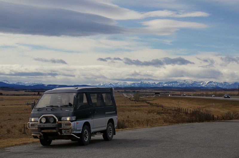
Stopped for a photo op at the turnoff for Cochrane, AB, about 20km W of Calgary:
Icing on the cake was getting the best fuel economy I've had since buying the van last fall:
Banff to Invermere: 220 km; 7.78 l/100km; 30.22 mpg
Return trip Radium to Calgary: 262km; 7.62 l/100km; 30.86 mpg
I reckon the big secret was keeping it slow - I cruised at 90-95km/h wherever possible and took it slow up the hills.
1991 L300 Exceed, High Roof, diesel, 5-spd


Re: Locate the Recreation Site
Thanks Outlet for the site report for the Whiteswan area. It is really nice in the summer but is a lot busier that's for sure. I think the hot springs are always busy.If you like the area you can go west of Canal Flats to Whitetail lake which is a great lake if your into fishing.
I'll add a lake that is easy for everyone to get to – but be ready for a few kms in 1 or 2 as the road is steep in a few places.
Bolean Lake is a high elevation Lake (4800 ')northeast of Falkland. The Rec site has a few lake side sites and some in the dense bush. The fishing tends to be mostly small fish. The road up the the lake is most interesting with several great vistas. The less than 10 km from the highway rises almost 2800 ' via multiple switchbacks. Arthur and Spa lakes are also in the area.
- Attachments
-
- Boat launch area
- 100_6705a.JPG (189.17 KiB) Viewed 4867 times
-
- Lake view North
- 100_6707a.JPG (207.45 KiB) Viewed 4867 times
-
- Road @ Lake
- 100_6708a.JPG (284.05 KiB) Viewed 4867 times
-
- Vista
- 100_6709a.JPG (215.44 KiB) Viewed 4867 times
-
- Route from Falkland
- Route.jpg (65.41 KiB) Viewed 4867 times